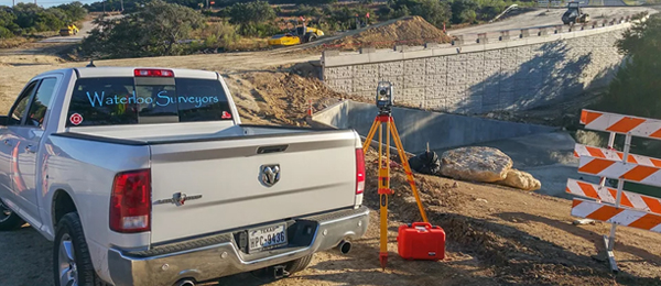

We’re a Leading Land Survey Company in Central Texas
Waterloo Surveyors, Inc. is a full service land surveying company based in Austin and working throughout Central Texas. Offering quality at a fair price, Waterloo Surveyors uses the latest in surveying technology to perform accurate, on time surveying. Our dedication to precision and our commitment to friendly service have given us the foundation needed to be a successful business. We invite you to join our list of satisfied clients.
Our Services
The following is a list of services offered.
-
Boundary Surveys
-
As-Built Surveys
-
Title Surveys (Commercial & Residential)
-
ALTA Surveys
-
Elevation Certificates
-
Topographic Surveys
-
Tree Location Surveys
-
Construction Staking
-
Form Surveys
-
Site Plans
-
Subdividing
-
PLAT Preparation
-
Fence Line Staking
-
Field Notes
-
Easement Dedication
-
DRONE Mapping
If you have a special request not listed below, tell us about it, we can either help you or refer you to someone who can.

Boundary Surveys
Locating, marking and measuring of the perimeter of a parcel of land. Typically includes a map or plat of the boundary with measurements.
As-Built Surveys
A boundary survey which includes the location of improvements to the property (house, walkways, utilities, swimming pools, etc.).
Title Surveys (Commercial & Residential)
As-built surveys which include relevant information (easements, setback lines, etc.) provided by a Title Commitment. Title surveys are typically required for a mortgage loan.
ALTA Surveys
Title surveys which meet the standards set by the American Land Title Association.
Elevation Certificates
A certificate which states the true mean sea level elevation of a structure or specific location and the elevation of the flood plain (as provided by F.E.M.A. or other local agency) for that location.
Topographic Surveys
A map of a parcel of land which includes contour lines representing the elevations and elevation changes.
Tree Location Surveys
A map of a parcel of land which includes the location, type and size of trees; along with the critical root zone, drip edge and canopy of trees on that parcel.
Construction Surveys
The physical placement of wood or metal stakes at specific locations to aid in construction.
Form Surveys
A map of a parcel of land which includes the location of wood forms prior to the pouring of a slab for an inspection and/or a bank draw.
Site Plans
A map of a parcel of land which includes the proposed location of improvements.
Subdividing
The physical placement of property monuments for the purpose of changing the existing boundary of a parcel of land.
Plat Preparation
A boundary survey of a tract of land whose property lines and/or number of tracts have been altered. Additional certifications and/or requirements are typically required by the appropriate jurisdiction.
Fence Line Staking
The physical placement of wood or metal stakes along a property line for the purpose of fence construction.
Field Notes
A document which describes the boundary of a tract of land using bearings, distances and monument descriptions
Easement Dedication
The map and/or field notes which describe a parcel of land to be designated as an easement, typically for the purpose of filling said easement with the appropriate jurisdiction.
Drone Mapping
Drone Photogrammetry (pho·to·gram·me·try) is new technology that delivers 2D (orthomosaic) Maps, Elevations, Contours, Point Clouds and 3D interactive Models.
DRONE Mapping


Waterloo Surveyors has teamed with Texas Hill Country Photography Construction Drone Services to bring Drone Photogrammetry to Austin. Drone mapping is used for development planning, construction job bidding, topographic surveys, architectural design, earthworks, stockpile volumetrics, monitoring construction progress and verification of contractor work.
Please contact Construction Drone Services for more information.


Orthomosaic
Digital Surface Model
Contours
About Us
Waterloo Surveyors has a long and established history, we've been in business for 15 years.
We believe if you enjoy your job, do good work and treat your clients like family, success will follow.
Derrick Dixon, our founder and President of the company, has been surveying since he was in high school, 25 years ago. He got his start in business working for his father, Tom, where he started out working on a survey crew summers and drafting during the school year. Tom Dixon now works for his son at Waterloo Surveyors.
Derrick was raised in Austin and went to UT. He's a native Austinite and a 15 year firefighter with the Austin Fire Department. Brian Sumner, our operations manager, is also a native Austinite. He attended Texas State down the road in San Marcos. Tom Dixon and Vince Boyce (our senior survey tech) are both from Corpus Christi although both have been living in Austin for over 30 years.
Waterloo Surveyors is like a big family, we have close ties that bind us together as a team.

Meet our Team

Derrick Dixon
Owner/Founder

Thomas Dixon R.P.L.S.
45 Years Surveying experience

Brian Sumner
General Manager
5 Years with Waterloo

Vince Boyce
Senior Survey Tech
25 Years Surveying experience
16 Years with Waterloo

Bernardo "Bobo" Wargo
Junior Survey Tech
20 Years Surveying experience
3 Years with Waterloo
Portfolio
These are a few examples of the types of survey projects that we conduct on a regular basis.
Commercial High Rise

GABLES AT REPUBLIC SQUARE
Survey Services performed:
-Pre-construction Design Survey
-Easement and Permit Document Preparation
-Foundation Layout and Pier Placement
-Site Well Monitoring
Status: Under Construction
Custom Residential

ABODE HOMES STRATFORD
Survey Services:
-Property As-Built and Design Survey
-Foundation Staking
Status: Under Construction
Apartment Complex

BELTERRA SPRINGS APARTMENTS
Survey Services:
-Property Survey and Pre-construction Design Survey
-Construction Staking including Utilities, Parking and Buildings
-Final ALTA Survey
Status: Completed 2016
Medical Center

LEGACY OAKS ASSISTED LIVING AND MEMORY CENTER
Survey Services:
-Property Survey and Pre-construction Design Survey
-Construction Staking including Utilities, Parking and Buildings
-Final Title Survey
Status: Completed 2017